Overview
The GIS Web Portal is an advanced geographic information system (GIS) web platform developed as an open-source alternative to the ArcGIS Web platform. This portal leverages a modern technology stack including Docker, Java Spring Boot, PostGIS, and React JS, providing robust capabilities for data management, web-based GIS server publishing, and interactive map editing.
Key Technologies
Docker: For containerization and deployment, ensuring consistency across different environments.
Java Spring Boot: Backend framework providing a reliable and scalable server environment.
PostGIS: A spatial database extender for PostgreSQL, enabling geographic object support.
React JS: A JavaScript library for building dynamic and responsive user interfaces.
Main Functionalities
1. Data Management
The GIS Web Portal offers comprehensive data management features to handle various geospatial data needs:
Import/Export Shapefiles: Users can import and export shapefiles, facilitating data exchange with other GIS systems.
GDB Layers: Support for Geodatabase (GDB) layers, allowing complex data structures and relationships.
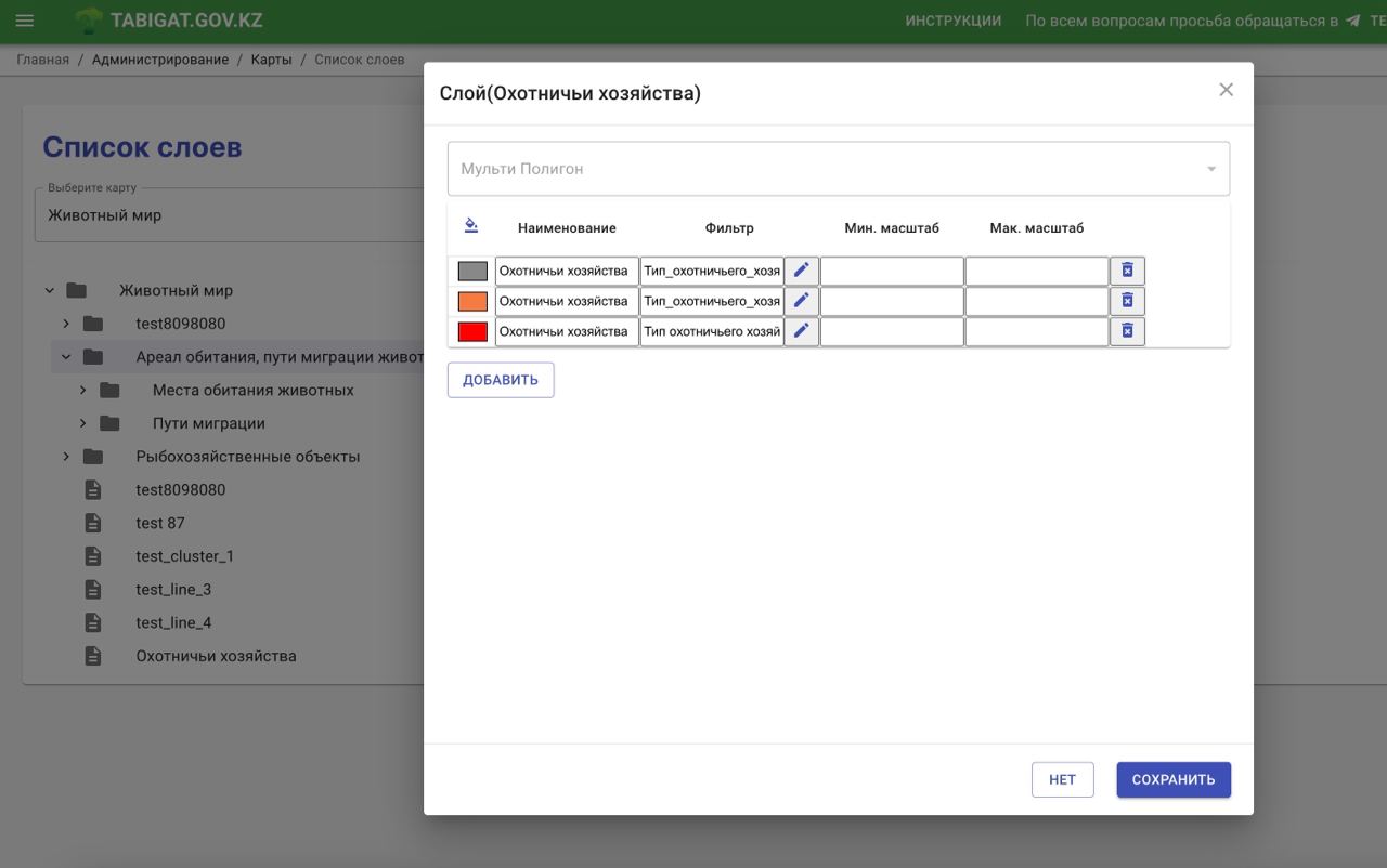
Custom Layer Creation/Edit: Users can create and edit custom layers with specific attributes to suit their unique requirements.
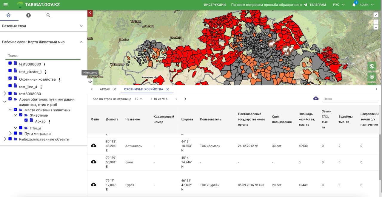
Render Styles with Column Filters: Provides tools to apply render styles based on column filters for better visualization.
Layer Authorization Configuration: Configurable access control to ensure data security and integrity.
2. Publishing Data in Web GIS Server and Rendering
The platform includes features for publishing and rendering geospatial data on the web:
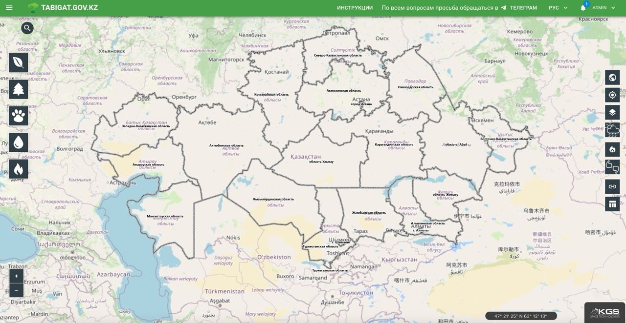
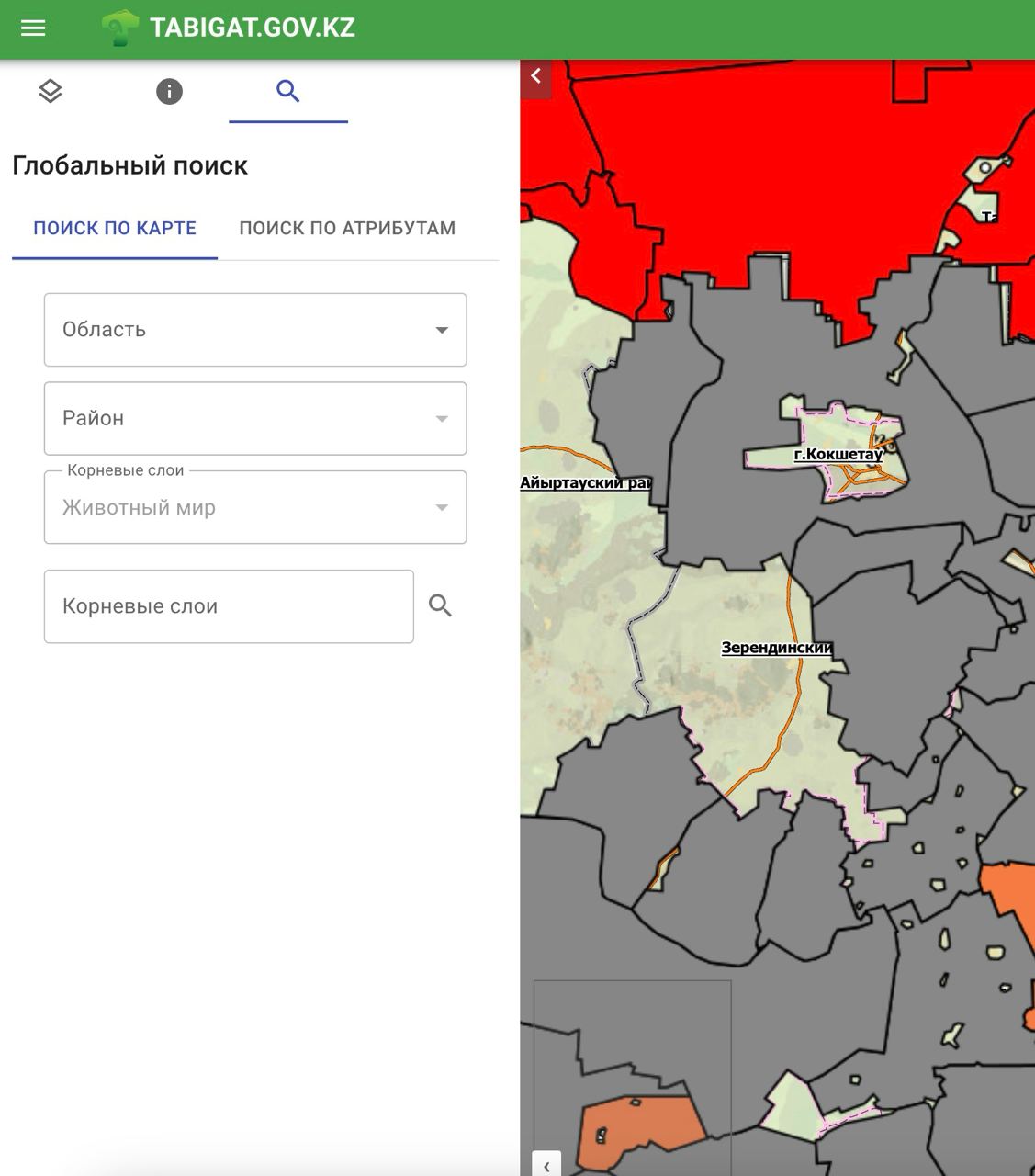
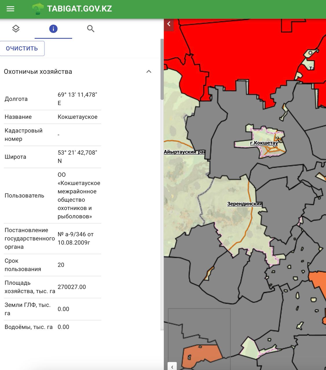
Data Rendering on Map: Efficiently renders spatial data on interactive maps.
Map Navigation Tools: Includes tools for zooming in and out, panning, and searching through layers for easy navigation.
Rendering Data by Authorization: Ensures that data visibility and access are controlled based on user authorization levels.
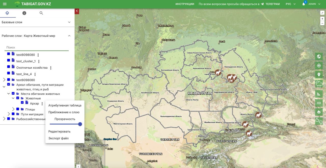
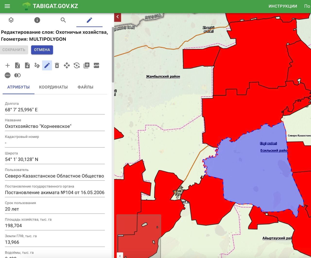
3. Layer Editor through Web Map
A robust web map editor allows users to interact with and modify geospatial data directly within the portal:
Create/Edit Feature Geometries: Users can create new features or edit existing geometries with associated attributes.
Attach Dictionaries to Fields: Allows for attaching predefined dictionaries to necessary fields to standardize data input.
Attach Files to Features: Users can attach relevant files to specific features, enhancing the richness of the data.
Conclusion
The GIS Web Portal is a powerful, open-source GIS solution designed to meet the diverse needs of geospatial data management, publishing, and editing. By leveraging modern technologies, it provides a scalable, secure, and user-friendly platform for GIS professionals and organizations.

I have been programming since 2012. Participated in various projects. Developed various calculation modules, web applications, desktop applications. Full-stack developer. I do both frontend and backend. I can design database architecture and perform analytical work. Quick learner. Not afraid of difficult tasks and challenges. Responsible. Honest. Goal-oriented. I can assemble a team of developers.